Prarion
1 000 – 1 900 mRolling summit plateau and forest
The heart of the area: gentle summit runs with 360° views, then long tree-lined descents back to the village.
Best for: Families and mixed-level groups
Les Houches · Plan your trip
Fifty-five kilometres of forest skiing with Mont Blanc filling the horizon. Gentle on the map and gentle in real life, with one glorious exception: the Kandahar downhill, where the World Cup comes to be terrified.
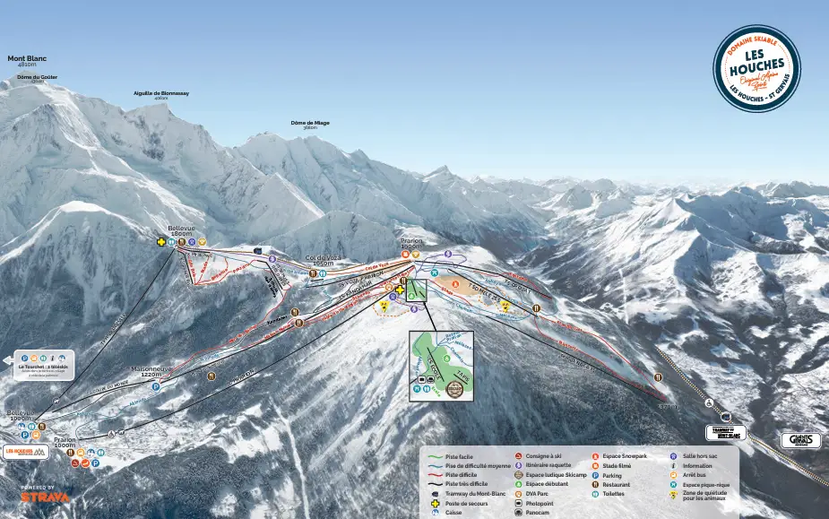
Official winter map, Les Houches - Saint-Gervais area.
Download the PDFRolling summit plateau and forest
The heart of the area: gentle summit runs with 360° views, then long tree-lined descents back to the village.
Best for: Families and mixed-level groups
Open balcony facing Mont Blanc
Reached by the historic cable car or the Tramway du Mont-Blanc; quieter blues and the start of the St-Gervais link.
Best for: Cruising with a view, lunch stops
North, 900 m of vertical
The FIS World Cup downhill. 3.3 km, walls, jumps and the La Cassure pitch; a proper test when open to the public.
Best for: Experts ticking off a legend
Why families start here
Sheltered, tree-lined, visually friendly and served by its own cheaper pass: for children's first full-mountain days, Les Houches beats anywhere else in the valley. Our Les Houches instructors know every quiet corner.Our instructors ski these mountains every day. Book a private lesson and get the pass, area and timing questions answered for free.